Using Global Positioning Systems to Monitor Changes in Lakes
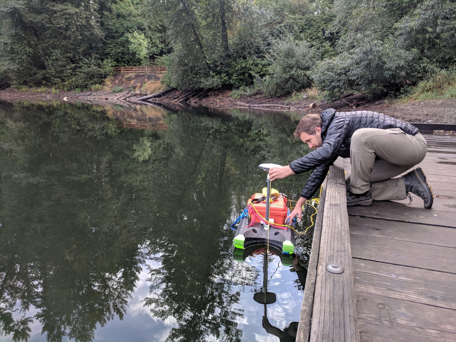 Tamlin Pavelsky, LOCSS Project Lead, sets up a floating GPS unit to measure the lake surface elevation.
We are working to better understand how the volume of water in lakes is changing over time. We do this by monitoring both the lake height and the surface area of lakes. The lake height is monitored by citizen scientists, who regularly read the water level against a fixed gauge and report it to the LOCSS team. On their own, these lake height measurements can tell us a lot about how an individual lake is changing over time, but lake height data can be especially useful when it is compared to a standard, such as the elevation above sea level. Fortunately, we have the ability to measure elevation using satellite based systems such as Global Positioning System (GPS).
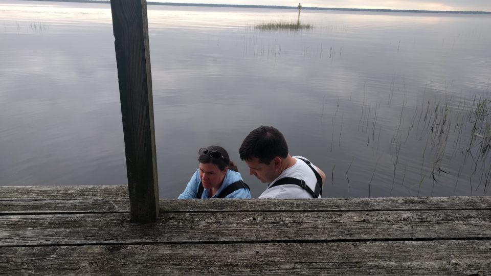
To determine the elevation of the lakes we study, we use a Septentrio PolaRx5, a GPS receiver that can measure elevation to within a few inches. The GPS receiver is placed in a heavy duty case and attached to a raft along with a GPS antenna. We then float the raft on the lake for at least an hour to get an accurate measurement of the elevation of the surface of the lake. During this time, we also take lake height measurements using the installed lake gauge so that we can convert lake height measurements on the gauge to lake surface elevations above sea level.
One reason we are interested in knowing the surface elevation is that it can serve as a fail-safe when something goes wrong with our installed lake gauge. If, for instance, a lake gauge is bumped by a boat and must be reinstalled, we can simply take another elevation measurement after the reinstallation so that we can compare lake height measurements from before and after the accident. Similarly, many of the lakes we hope to study in the coming years will freeze in the winter. In these lakes, our gauges will need to be removed in the fall and reinstalled the following spring. Having elevation measurements will help us connect data sets for these lakes from one year to the next.
In the long term, we want to compare lake elevations measured by citizen scientists against measurements from the Surface Water and Ocean Topography (SWOT) mission, which will also provide elevations relative to sea level.
In the coming months, we hope to share elevation data for our lakes on our View Lake Data page, so stay tuned!
LOCSS News
We share stories about the lakes in our study, our partners and volunteer citizen scientists, as well as interesting results from our research.